|
|
|
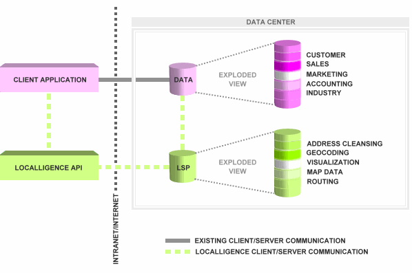
The
Localligence solution is built around a server-based platform
that "spatially enables" an enterprise's corporate data.
Once enabled, client applications are able to access this
data directly or via Localligence APIs. If accessing the
data directly, spatial operations and queries can still be
performed, but the results will not be displayed over a map.
To display the same operations and queries on a map the
client application would have to be tailored or custom built
with the Localligence APIs. (The green dashed line in the
illustration below.)
Illustration: The Localligence Spatial Platform (LSP) and
API Integration Model
 |